
“Digital twin” point cloud access
On Ayelix you have visual representation of the site object that you are working on. 3D Laser scans data based on facility coordinates calibrated with plot plan let you quickly view specific area, check coordinate position and easily create measurements. You can feel like you are there by remotely rewiewing Ayelix pointcloud data.
High quality panoramas
Some parts of the object do not need point cloud data but it is important to see the area details – like accommodation or walking paths for new employees that will need some help navigating on the facility, or to report part of machine that need to be fix or find missing identification signature. Because of that we’ve prepared ImageOnMap Panorama KIT solution where we rent equipment or provide services for making high quality panoramas.
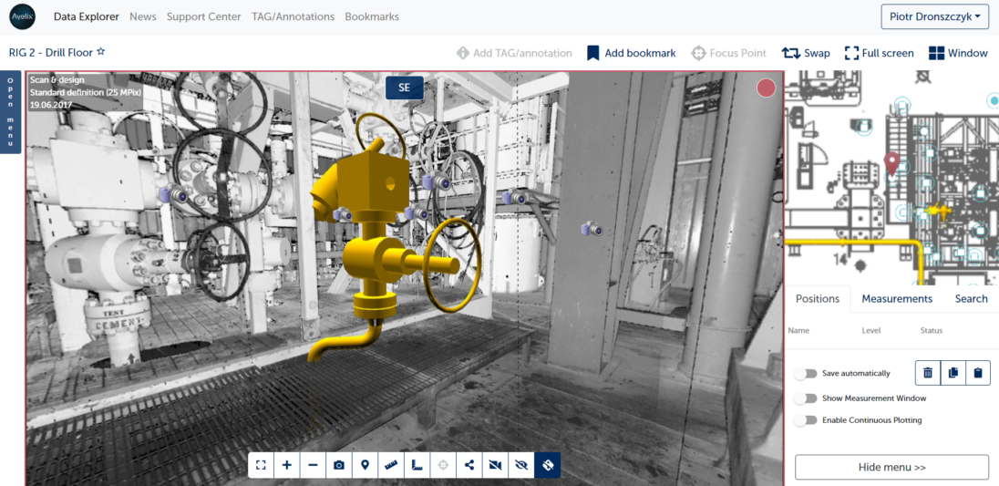
See models imprinted in your site
Your 3D models imprinted straight into scanned data allows you to see how your project fit into reality and easily present it to your team or a customer. You can also review your design, share it with your coworker or make global for all company. Just upload .dwg file and see your design shows in the point cloud data.
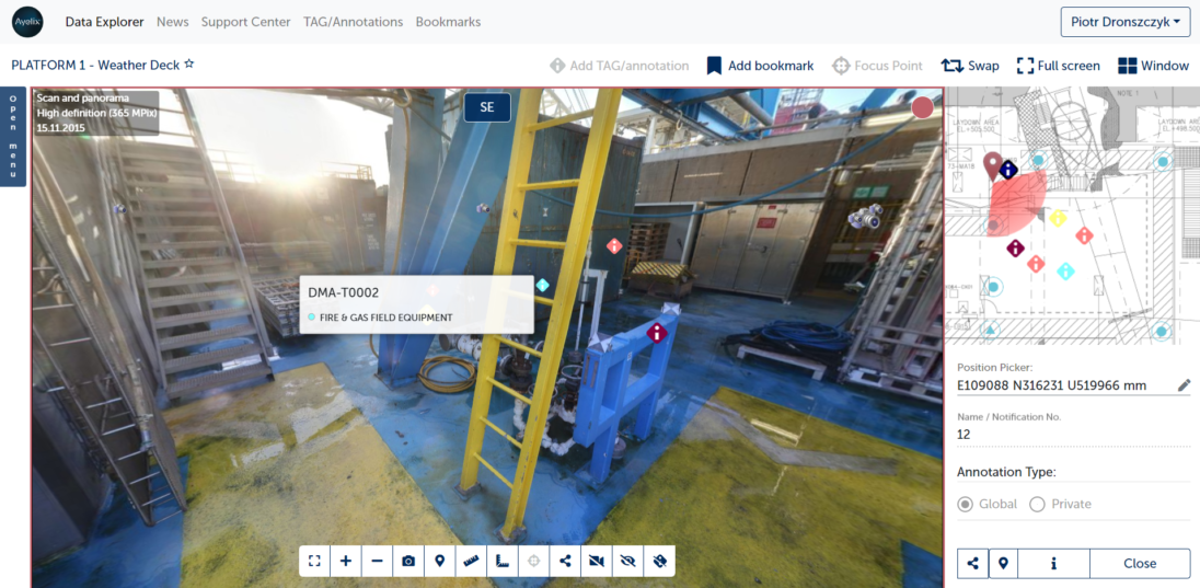
Create annotations and TAGs in the point cloud data
On Ayelix you can easily tag on anything that needs further inspection or requires attention in any way – like place where something needs to be fix (notification tags) or on important equipment (equipment tags). Tags can be private, or you can send them to your coworker or make visible for everyone so you can adapt them to your and your company’s needs.